Fil:Itinéraire du Pourquoi-pas.svg
Spring til navigation
Spring til søgning


Size of this PNG preview of this SVG file: 477 × 503 pixels. Andre opløsninger: 228 × 240 pixels | 455 × 480 pixels | 728 × 768 pixels | 971 × 1.024 pixels | 1.942 × 2.048 pixels.
Oprindelig fil (SVG fil, basisstørrelse 477 × 503 pixels, filstørrelse: 444 KB)
Filhistorik
Klik på en dato/tid for at se filen som den så ud på det tidspunkt.
| Dato/tid | Miniaturebillede | Dimensioner | Bruger | Kommentar | |
|---|---|---|---|---|---|
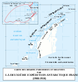
| nuværende | 8. apr. 2008, 18:36 |  | 477 × 503 (444 KB) | wikimediacommons>Bourrichon | {{Information |Description= {{fr|Carte de la Péninsule Antarctique avec l'itinéraire du ''Pourquoi-pas IV'' (1908-1910).}} {{en|Map of en:Antarctic Peninsula with the route of the ship [[:en:Po |
Filanvendelse
Den følgende side bruger denne fil:
